
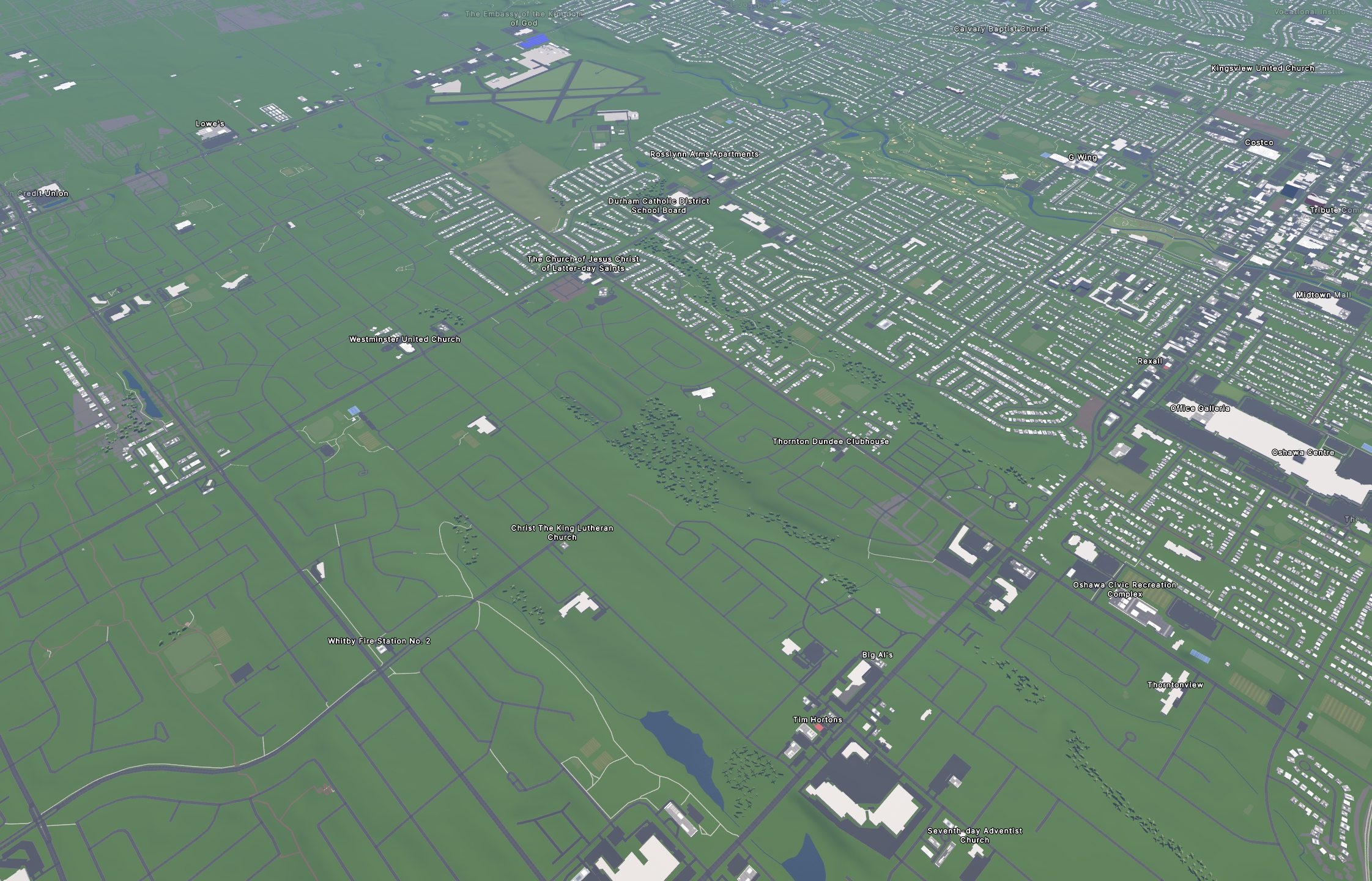
I used https://streets.gl for the “Google Earth” view of the OSM data.
Much of the work was done with the help of https://rapideditor.org/, although there was also a LOT of manual tracing and corrections along the way.
We have so much new development in the area that I had to rely on some pretty updated satellite images and local surveying to get most of that done (with more to be done in the future as several hundred more homes go up this year).
I used a combination of Bing, ESRI world imagery (the regular, not “clarity” beta), and Maxxar Premium imagery.
Totally worth it!
Nice! Rapid is developed by Meta, are you granting them any rights of your work when you use it?
Yeah, and I hate the fact that they actually made a good product out of 100 evil ones.
No. They say that “All data provided through RapiD is open source under the MIT license.”, which is totally fine with me.
Their more detailed TOS doesn’t give me any pause for concern, either.
Same with the OSM terms, which basically say the data is open, provided you credit OSM when you use the data.
Thanks a bunch, will give it a spin then!
The traced buildings go to OSM. Meta uses OSM, but lots of other entities do, too. So, if I’m correct then Meta has no ‚rights‘ on your work, but uses it, as part of OSM.