
Thanks. Fair point about beggars can’t be choosers.
I may add a rule in the description about attributing the original creator. That seems appropriate – and the least we could ask.
Thanks. Fair point about beggars can’t be choosers.
I may add a rule in the description about attributing the original creator. That seems appropriate – and the least we could ask.
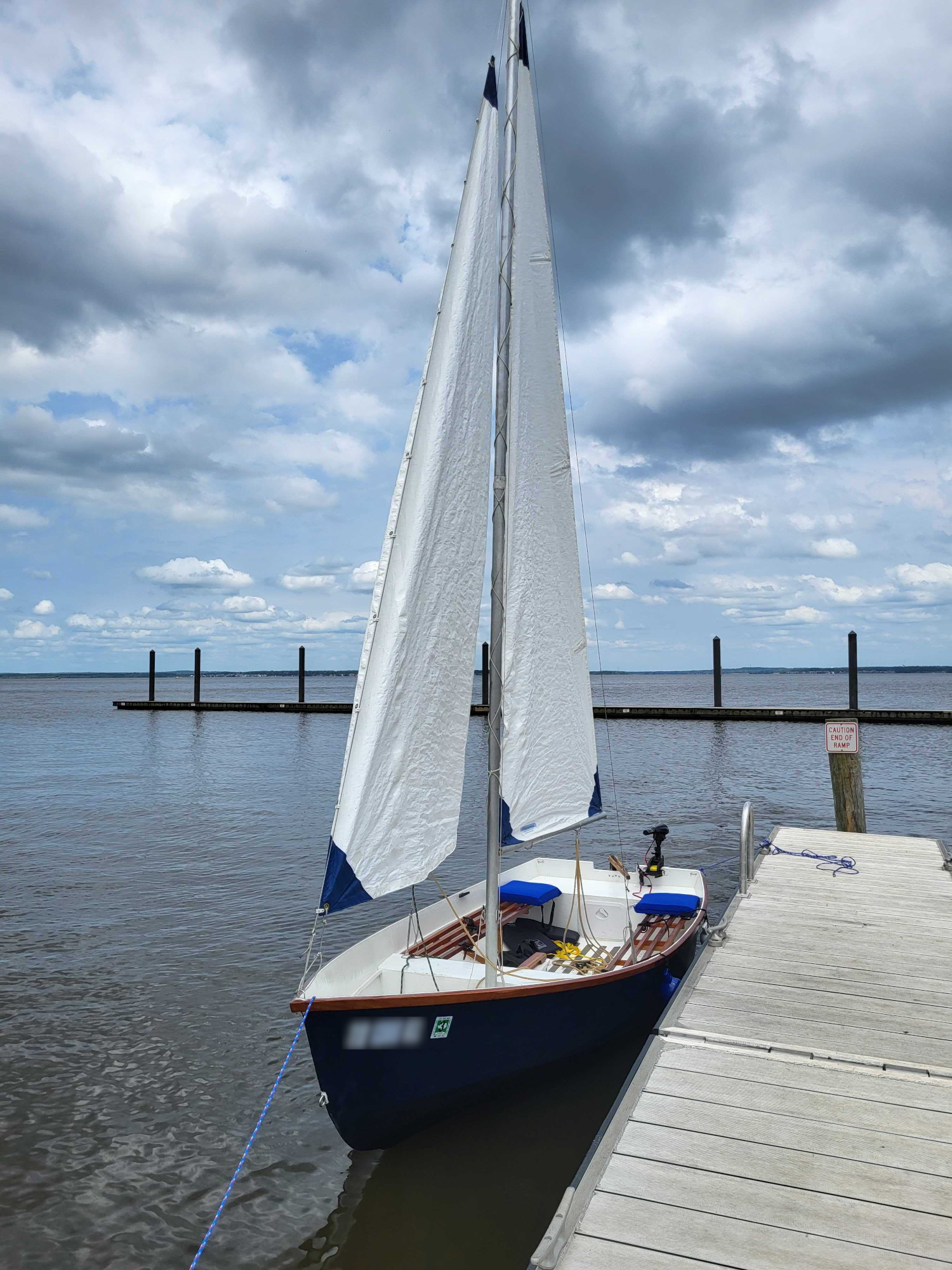
Yep! It took about 6-9 months the summer of 2021. It’s a rough ride, and I’m not always thrilled with the performance. If it breaks, though, I get to keep all the pieces, and sometimes I even know how to put them back together!
The design was chosen because it was about as big as I could get and still fit it on a trailer in the garage.
Yeah, it surprised me how short the tiller was. I constructed it just as the design described it, but this was one of Dudley Dix’s early designs, I believe. It’s the Argie 15.
I did make one change early in the life of this boat: the tiller definitely swivels up and down now!
I’ve seen part of the review from Logos by Nick. He seemed pretty excited about it, too.


I’m realizing my knowledge of how to do this is really dated. I got into QGIS plugins 15 years ago, and at that time there were some links on the QGIS website to plugin tutorials across the web. I’m not finding that now.
I do know I started with the QGIS documentation, and it looks like these days they point you to the PyQGIS Developer Cookbook as the starting point. It is also probably worth wandering around the dedicated QGIS plugin website. I strongly suspect you’ve already done both of these, though.
I do remember that the learning curve was steeper than I expected. If you go the route of a Python plugin like I did, before it is said and done, you’ll likely need to be comfortable with at least some Qt, PyQt, the QGIS Python API, and details about the tools to manipulate the data you’re working with. In my case that was PostGIS and pyscopg2, the Python PostgreSQL library.
I’d strongly recommend you start very simple. Manipulate a few things in the Python console. Work your way up to a bare bones plugin that provides a single menu option. Then start building up from there.
I’ll be very curious to see if others have links to tutorials they’ve tried recently. There’s the usual route of checking Google and YouTube, but I cannot tell you what is reliable there and what isn’t.
I stumbled into GIS. Mine is not a “GIS career,” but it’s been very GIS-centric at several points.
I first stumbled into mapping projects when I was measuring time and frequency shifts from satellites as an electrical engineer. Satellite ephemeris mattered, and so did the shape of the earth. And when you’re tracking things on the surface of the earth, you have to map them.
My next stop was in the context of an electric utility where we had to do everything from tracking the location of physical plant to calculating path loss for microwave links. Finally, off in grad school for something completely unrelated, I found myself working utility problems as a consultant. I stumbled into Postgres/PostGIS, then QGIS, then GeoServer and MapServer. I was hooked from there on out.
It still remains an ancillary part of what I do, but I’m as likely to open QGIS for a personal project as work.
Apologies for the late response. I hadn’t posted any rules yet, but I’m certainly open to suggestions.
I’d like to lean in the direction of less than more on the rules and then deal with problems as they come up.
I’ll modify the description to include some brief rules, and then we probably need to bring it up for discussion at some point. Provided we start to see some traffic.
[Full disclosure: I’m a director at a large software company (not ESRI!), and I’m not entirely sure our own HR department includes pay range in all their job postings – although that may be changing right now with various rule changes at the state level in the US.]
This right here: Linux From Scratch (LFS).
If your goal is to learn, there is no better way than retrieving each tool individually and compiling it from the bottom up. LFS is Gentoo … without all the ease of use built in. More accurately, LFS is a just a set of instructions for where to go to get the code and how to compile everything you need to build a Linux system from the bottom up.
I don’t live in the world of LFS or Gentoo, but my foray into LFS gave me a much greater appreciation for the distribution(s) I do use as daily drivers. I greatly appreciate my distribution maintainers.

Edgar Rice Burroughs’ John Carter books are public domain. They’ve got those on Project Gutenberg, but they may be too much “stock characters” for you.
Would some of the Lewis Carroll stuff scratch the “science fiction” itch?
It’s a bit of a stretch, but Mark Twain’s Connecticut Yankee in King Arthur’s Court at least has the character development. And, strictly speaking, it is time travel. ;)
Finally, if quasi-fantasy and mythopeia do anything for you, there are things like George Macdonald’s Phantastes and G. K. Chesterton’s The Man Who Was Thursday. Both those authors were influences on C. S. Lewis. But we’re really straying away from anything that’s strictly science fiction there.
This fascinates me, but I’ve got stupid questions:
Late to reply here, but I greatly appreciate this summary of the ESRI options. As with many things ESRI, it’s often very difficult to sort out the array of options.
A decade ago, I might have suggested Ubuntu because it seemed like a lot of the open source GIS development was taking place on Ubuntu. It ran fine on RedHat derivatives; it was just a little easier to get running quickly on Ubuntu. However, even then that was probably more true for QGIS and friends than the server side stuff.
Fedora and Ubuntu would both be perfectly adequate. Part of it depends on what makes you most comfortable. If you ever plan to deploy this for someone else, though, it’s a good idea to find out what environment works best for them.
If this is primarily (or even partly) about learning, stick with the OS you’re familiar with and concentrate on just learning the tools. If your primary interest is using the tools, you might go with the suggestion from @key – begin with one of the containers. On the other hand, if you really want to know how the pieces go together, there is no substitute for installing those pieces (PostgreSQL, PostGIS, Tomcat, Geoserver) one piece at a time and fitting them together.
(Full disclosure: Xubuntu is my daily driver and Ubuntu server is what we use at work.)
RedHat here in the late 90s, back when you could still find yourself writing a “modeline.”
Then Debian in the early 00s when apt was still a major discriminator. Finally, Ubuntu around 2008 just so I was running the same thing I was recommending to family members for ease of use. (At the time, Ubuntu sported the same ease of installation and hardware detection I’d found with Knoppix.)
Now on Xubuntu, but seriously eyeing a return to Debian.


Very kind of you, Mr. Boycott Reddit Bot. Thank you. ;)