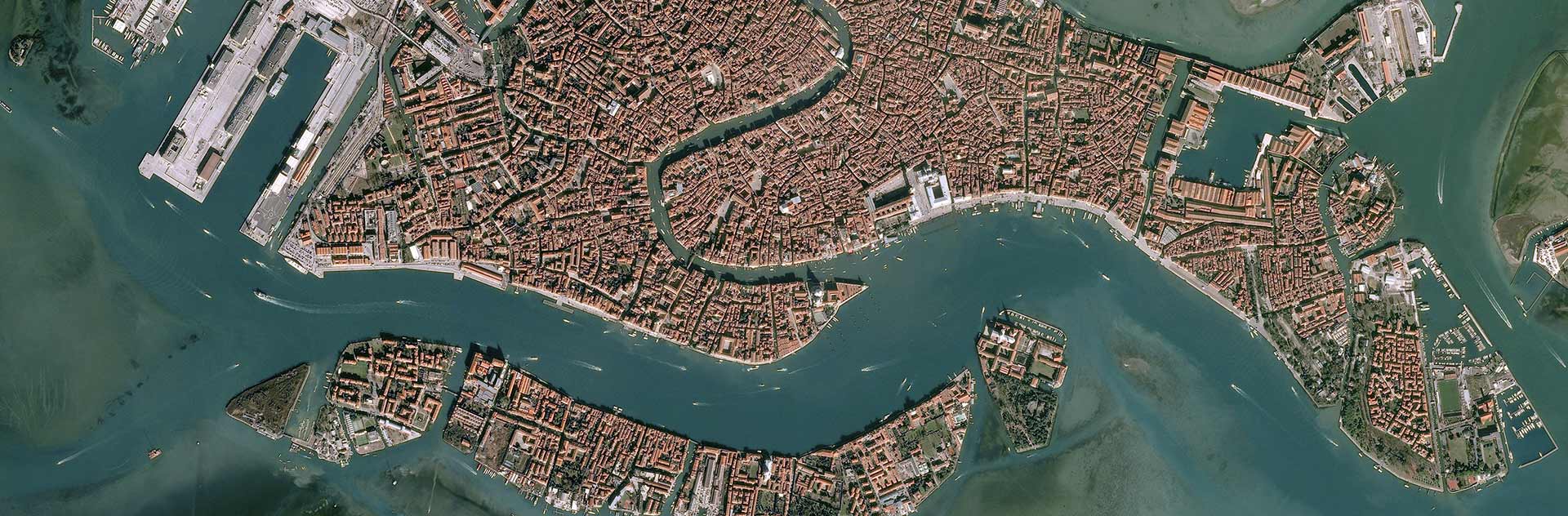
fossilesqueMEnglish · 2 years agoMods wanted!plus-squarepinmessage-squaremessage-square3fedilinkarrow-up13arrow-down10
arrow-up13arrow-down1message-squareMods wanted!plus-squarepinfossilesqueMEnglish · 2 years agomessage-square3fedilink
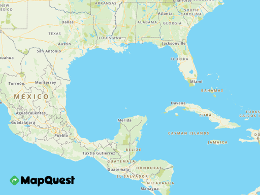
fossilesqueMEnglish · 8 days agoGulf of Map Explorer: Name your own gulfplus-squaregulfof.mapquest.comexternal-linkmessage-square4fedilinkarrow-up144arrow-down10
arrow-up144arrow-down1external-linkGulf of Map Explorer: Name your own gulfplus-squaregulfof.mapquest.comfossilesqueMEnglish · 8 days agomessage-square4fedilink
Lazycog@sopuli.xyzEnglish · 9 days agoOpenGlobus: an Open-Source web map application library to display maps on a globeplus-squaregithub.comexternal-linkmessage-square0fedilinkarrow-up14arrow-down10
arrow-up14arrow-down1external-linkOpenGlobus: an Open-Source web map application library to display maps on a globeplus-squaregithub.comLazycog@sopuli.xyzEnglish · 9 days agomessage-square0fedilink
fossilesqueMEnglish · 12 days agoMapTCHA, the open source CAPTCHA that improves OpenStreetMapplus-squarefosdem.orgexternal-linkmessage-square0fedilinkarrow-up120arrow-down10
arrow-up120arrow-down1external-linkMapTCHA, the open source CAPTCHA that improves OpenStreetMapplus-squarefosdem.orgfossilesqueMEnglish · 12 days agomessage-square0fedilink
fossilesqueMEnglish · 12 days agoApache Iceberg and Parquet now support Geospatial Dataplus-squarewherobots.comexternal-linkmessage-square0fedilinkarrow-up16arrow-down10
arrow-up16arrow-down1external-linkApache Iceberg and Parquet now support Geospatial Dataplus-squarewherobots.comfossilesqueMEnglish · 12 days agomessage-square0fedilink
fossilesqueMEnglish · 17 days agoOSM Meta Thread: Gulf of America - Gulf of Mexicoplus-squarecommunity.openstreetmap.orgexternal-linkmessage-square2fedilinkarrow-up119arrow-down11
arrow-up118arrow-down1external-linkOSM Meta Thread: Gulf of America - Gulf of Mexicoplus-squarecommunity.openstreetmap.orgfossilesqueMEnglish · 17 days agomessage-square2fedilink
fossilesqueMEnglish · 18 days agoMapping Antarctica’s hidden ice-free lands: a blueprint for conservationplus-squarewww.unsw.edu.auexternal-linkmessage-square0fedilinkarrow-up16arrow-down10
arrow-up16arrow-down1external-linkMapping Antarctica’s hidden ice-free lands: a blueprint for conservationplus-squarewww.unsw.edu.aufossilesqueMEnglish · 18 days agomessage-square0fedilink
fossilesqueMEnglish · 1 month agoThe Powerful AI Tool That Cops (or Stalkers) Can Use to Geolocate Photos in Secondsplus-squarewww.404media.coexternal-linkmessage-square0fedilinkarrow-up111arrow-down10
arrow-up111arrow-down1external-linkThe Powerful AI Tool That Cops (or Stalkers) Can Use to Geolocate Photos in Secondsplus-squarewww.404media.cofossilesqueMEnglish · 1 month agomessage-square0fedilink
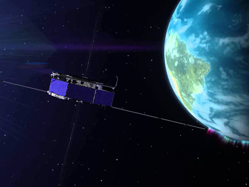
fossilesqueMEnglish · 2 months agoGlobal Navigation Satellite System Data Brings Forth a GUARDIAN | NASA Earthdataplus-squarewww.earthdata.nasa.govexternal-linkmessage-square0fedilinkarrow-up14arrow-down10
arrow-up14arrow-down1external-linkGlobal Navigation Satellite System Data Brings Forth a GUARDIAN | NASA Earthdataplus-squarewww.earthdata.nasa.govfossilesqueMEnglish · 2 months agomessage-square0fedilink
fossilesqueMEnglish · 3 months agoHOT Volunteer Mappers: Volunteers, we need your help! 1 billion people are living in places that are partially or completely unmapped. Volunteer and help put vulnerable communities on the map.plus-squarewww.hotosm.orgexternal-linkmessage-square1fedilinkarrow-up117arrow-down11
arrow-up116arrow-down1external-linkHOT Volunteer Mappers: Volunteers, we need your help! 1 billion people are living in places that are partially or completely unmapped. Volunteer and help put vulnerable communities on the map.plus-squarewww.hotosm.orgfossilesqueMEnglish · 3 months agomessage-square1fedilink
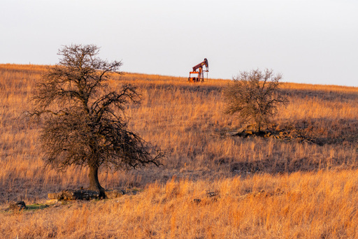
fossilesqueMEnglish · 3 months agoAI Helps Researchers Dig Through Old Maps to Find Lost Oil and Gas Wellsplus-squarenewscenter.lbl.govexternal-linkmessage-square1fedilinkarrow-up16arrow-down14
arrow-up12arrow-down1external-linkAI Helps Researchers Dig Through Old Maps to Find Lost Oil and Gas Wellsplus-squarenewscenter.lbl.govfossilesqueMEnglish · 3 months agomessage-square1fedilink
fossilesqueMEnglish · 3 months agoUsing GPS in the year 1565 – verbeeldplus-squarewww.verbeeld.beexternal-linkmessage-square0fedilinkarrow-up13arrow-down10
arrow-up13arrow-down1external-linkUsing GPS in the year 1565 – verbeeldplus-squarewww.verbeeld.befossilesqueMEnglish · 3 months agomessage-square0fedilink
fossilesqueMEnglish · 3 months agoOpenStreetMap's New Vector Tilesplus-squaretech.marksblogg.comexternal-linkmessage-square0fedilinkarrow-up18arrow-down10
arrow-up18arrow-down1external-linkOpenStreetMap's New Vector Tilesplus-squaretech.marksblogg.comfossilesqueMEnglish · 3 months agomessage-square0fedilink
fossilesqueMEnglish · 3 months agoMapping the ionosphere with millions of phones | Natureplus-squarewww.nature.comexternal-linkmessage-square0fedilinkarrow-up15arrow-down10
arrow-up15arrow-down1external-linkMapping the ionosphere with millions of phones | Natureplus-squarewww.nature.comfossilesqueMEnglish · 3 months agomessage-square0fedilink
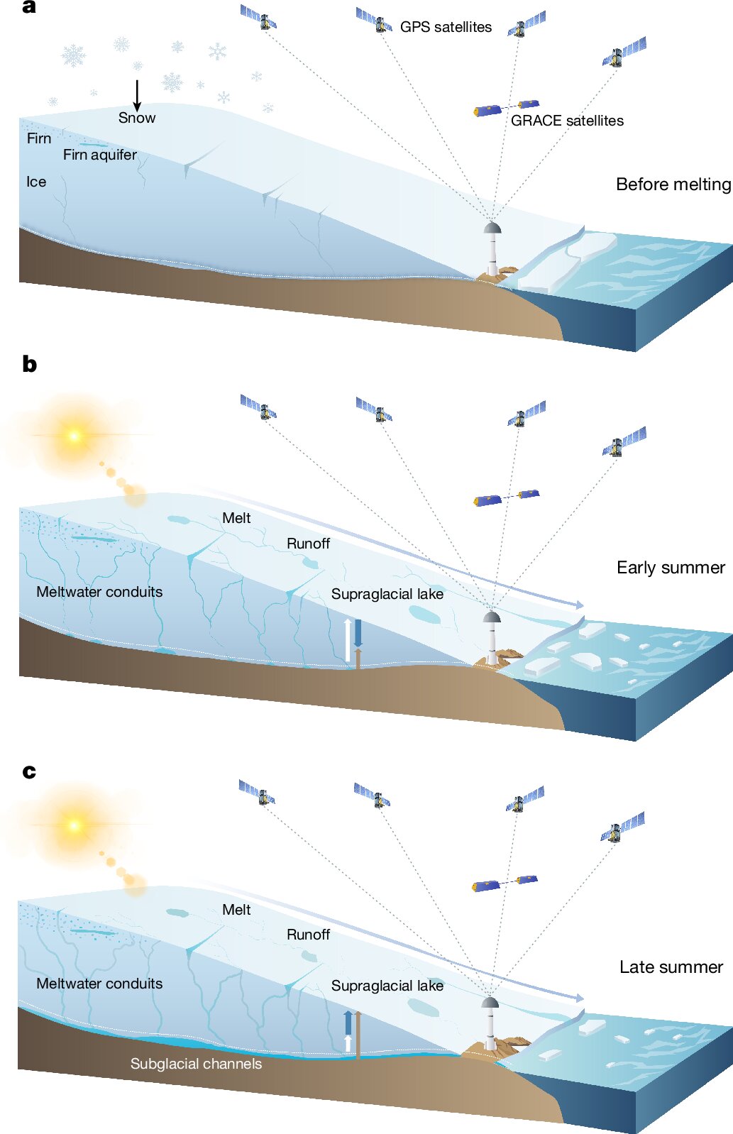
fossilesqueMEnglish · 4 months agoLarge meltwater accumulation revealed inside Greenland Ice Sheetplus-squarephys.orgexternal-linkmessage-square0fedilinkarrow-up123arrow-down10
arrow-up123arrow-down1external-linkLarge meltwater accumulation revealed inside Greenland Ice Sheetplus-squarephys.orgfossilesqueMEnglish · 4 months agomessage-square0fedilink
boredsquirrel@slrpnk.netEnglish · edit-24 months ago[DE] Contribute network location data to get location everywhere without sattelites!plus-squaretux.socialexternal-linkmessage-square0fedilinkarrow-up14arrow-down10
arrow-up14arrow-down1external-link[DE] Contribute network location data to get location everywhere without sattelites!plus-squaretux.socialboredsquirrel@slrpnk.netEnglish · edit-24 months agomessage-square0fedilink
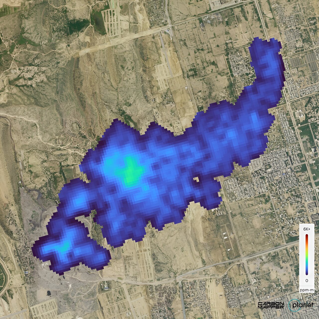
fossilesqueMEnglish · 5 months agoFirst greenhouse gas plumes detected with NASA-designed instrumentplus-squarephys.orgexternal-linkmessage-square0fedilinkarrow-up126arrow-down10
arrow-up126arrow-down1external-linkFirst greenhouse gas plumes detected with NASA-designed instrumentplus-squarephys.orgfossilesqueMEnglish · 5 months agomessage-square0fedilink
fossilesqueMEnglish · 5 months agoHurricane Milton Tracking Console | Milton Spaghetti Models, Track Forecast Cone, Path, Wind Maps — Hurricane Trackerplus-squarewww.hurricanetracker.netexternal-linkmessage-square0fedilinkarrow-up124arrow-down11
arrow-up123arrow-down1external-linkHurricane Milton Tracking Console | Milton Spaghetti Models, Track Forecast Cone, Path, Wind Maps — Hurricane Trackerplus-squarewww.hurricanetracker.netfossilesqueMEnglish · 5 months agomessage-square0fedilink
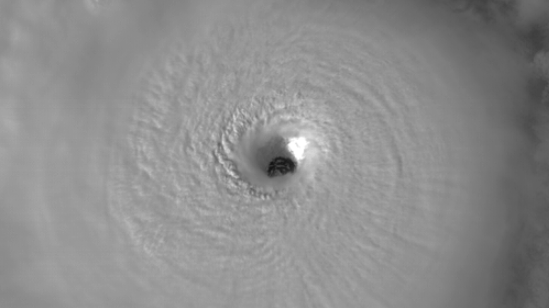
fossilesqueMEnglish · 5 months agoHurricane Milton’s Clear, Breathtaking Eye - RAMMB-CIRA Satellite Libraryplus-squaresatlib.cira.colostate.eduexternal-linkmessage-square6fedilinkarrow-up139arrow-down10
arrow-up139arrow-down1external-linkHurricane Milton’s Clear, Breathtaking Eye - RAMMB-CIRA Satellite Libraryplus-squaresatlib.cira.colostate.edufossilesqueMEnglish · 5 months agomessage-square6fedilink
fossilesqueMEnglish · 5 months agoEnd of an era: Historic Landsat 7 mission takes final images | U.S. Geological Surveyplus-squarewww.usgs.govexternal-linkmessage-square0fedilinkarrow-up18arrow-down10
arrow-up18arrow-down1external-linkEnd of an era: Historic Landsat 7 mission takes final images | U.S. Geological Surveyplus-squarewww.usgs.govfossilesqueMEnglish · 5 months agomessage-square0fedilink